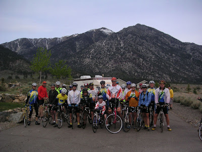
East Fork Carson River - Hangman's Bridge to Nevada
Looking downstream from Hangman's Bridge, we see a flat pool with a riffle below. (#1) This area gets HAMMERED by every fisherman on the stream! The pool contains smaller fish, with an occasional bigger fish caught before sunrise or after sunset. You can catch fish against the cliffs on the West side (left downstream), but it requires placing your fly within 6" of the cliff and immediately mending the line to stop drag. Whenever there's a hatch, you will see fish rising against that cliff. Guaranteed! Unfortunately, last year's floods undercut the roots of the big tree on the right, so it's no longer there to shade this pool.
Approximately 1/4 mile downstream, (#2) is a large pool (in the shaded area) before the river forks. Drift a weighted nymph into the head of this pool. If no luck, head downstream to where the forks rejoin, and another riffle-into-pool opportunity exists. But don't spend a lot of time here unless you see fish actively feeding. You may see dark caddis flies flitting about the rock cliffs, and this can start the fish feeding once the light gets off the water. But also keep a lookout for bats flying right after sunset. Occasionally, a good fish is found in the smaller of the forks, since few people fish that side. After the Spring runoff subsides, a channel to the left of the tree starts to dry up, and trout can get trapped in this area. Last year I netted a 14" Rainbow in about 5" of water, transported it to the river, and released it. So keep your eyes open and help the fish when you can.
The river makes a sharp left turn as it hits these banks, about a half-mile downstream (#3). Good fish hide in this turn, and it's a near-impossible cast. Persistance may reward you with a fish over 16" here. The next 1500 yards downstream reveals a series of holes and runs that fish quite well. I have landed trout up to 18" here. Last Fall, trout in this area were following dry flies for 10-20 feet, then bumping the fly with their noses (mouths closed), then turning away. As my Dad once said: "Humans are like fish: If they learned to keep their mouths shut, they would stay out of trouble!" These fish are learning!
This is another cliff/pool area (#4), below where Markleeville Creek enters the East Carson (1.5 miles downstream from Hangman's Bridge). The andesite cliffs always make me think that dinosaurs could be lurking nearby, and I sometimes climb to the top for "spying" down on fish. "The one that got away" was here, when I spied a HUGE fish (looked like a salmon!) working the tail of the riffle above this pool. I put on a big weighted stone fly nymph, re-tied a new tippet with 3X steelhead leader, and went after that monster. BAM!!! He takes the stonefly, then runs toward me as I haul in slack furiously, then turns downstream in a burst that strips the nylon gear in my multiplier reel, jams my line, and straightens out a #6 heavy-duty hook to get away. The fish never jumped, so was probably a big Brown trout, which I guess could have exceeded 8 lbs. And I'll bet he's still in there, older and wiser and bigger! I bought a new single-action disc-drag reel, so next time.....
This part of the river (#5) is where the trail from the Alpine County Airport meets the river (approximately 3 miles from Hangman's Bridge). Awfully pretty, don't you think? I sat here one day eating my sandwich and watched a buddy tease a 14" Rainbow with an assortment of dry flies. The Bow would roll at the fly (but not take it) three or four times, then refuse to show again for that particular fly pattern. My buddy would change to a different pattern, and it would happen all over again with the new pattern. An hour later, we were both chuckling at this Rainbow's antics (which he never caught). But that's why it's called FISHING, instead of CATCHING.... When you think you have learned the holes and runs, Mother Nature comes along with a flood and re-arranges all the rocks. This area always changes, since the waters of the Carson, Markleeville creek, and the Curtz Lake drainage impact here. So relearning is required.
Big Hole in the Canyon (#6) 3.5+ miles downstream from Hangman's Bridge. Well, was it worth the hike? On this very hot Summer day, I was wading in shorts, drank all my bottled water, fished all day, and only caught 4 fish. This Rainbow took a #18 pheasant tail nymph drifted just under the surface at the end of the drift (NOT where I was expecting a take). You just never know...and he's still in there waiting for you to catch him this season!
END OF THE TOUR: From beyond this point "There Be Dragons" (even the map stops!). The Canyon gets quite rugged, the elevation has now dropped to around 5300 ft, with rattlesnakes and wild animals occupying the land. It's also a long way from help if something bad happens, so this is where our virtual tour ends. (And I must keep a few "secret places" too, OK?).
Hatches and Flies
The Usual Suspects...Nymphs, Etc: #4 Wooly Buggers, #14 Prince, #14 Beadhead Caddis, #14-#16 Hares Ears, #16-#18 Pheasant Tail, #18 Baetis, and #18-#22 Midge nymphs. Dry Flies: #10 Hoppers (red or blue wing), #12-#14 Royal Wulff, #8-#12 Stimulators (yellow or orange), #14 Elk Hair Caddis (yellow), #16 Adams, #18-#20 PMD, #20 Tricos.
Stonefly shucks/nymph Golden Stoneflies: Although my net samples seldom turn up a black Pterorarcys californica Stonefly, large Golden Stoneflies abound in the water year-around, and emerge anywhere from July through September. The nymphs are up to 2" long, and are a mottled brown-tan-yellow. Although I seldom observe flights of adults back to the water, the nightly emergence coats the rocks (see photo). I am coming to the conclusion that these insects prefer to crawl from the water to bushes (and back), since I have observed this behavior more often than I have seen adults flying. Using #4 weighted nymphs in fast-water riffles just before sunrise can produce violent strikes, so use heavy tippet. An hour after the sun hits the water, fish stop taking these nymphs, and it's time to switch to another pattern. The dry fly patterns that best imitate the adults are #6 Sofa Pillows, #6-#8 Madam X, and #8-#10 Stimulators, all with tan-orange bodies. I don't know if the fish think these are Stoneflies or Hoppers or Giant October Caddis, but they will work if presented drag-free.
Giant October Caddis: The huge Discosmoecus Caddisfly inhabits the river, hence a #8 Burnt-Orange Sparkle Pupae nymph, or a #8-#10 Orange Elk Hair Caddis or #8-#10 Stimulator will interest the fish during early October. Ralph Cutter's Tangerine Dream #8 works too!
Access
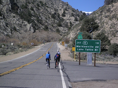
The East Carson River runs east of Markleeville, CA. Once you get to Markleeville, continue South through town on Highway 89, and go 1.5 miles to a bridge. You are now at Hangman's Bridge (yes, a hanging did occur there...someone who kept too many trout, I hear :) The river runs from Southwest to Northeast, from the mountains through the canyon and out into the Nevada desert.
Dirt parking areas are on both side of Hangman's Bridge, but cross over the bridge and park on the South side. There are toilets here, and you can access the old jeep trail by climbing over the locked gate. Access to the Catch-and-Release section is limited to five approaches:
- At Hangman's Bridge, wade downstream or follow the banks (if water levels allow).
- At Hangman's Bridge, hike along the old jeep trail paralleling the river.
- Hike down into the canyon on the trail from the Alpine County Airport.
- Hike down Markleeville Creek from the creek campground.
- Jeep in from Nevada off the Leviathan Mine Road along Bryant Creek.
Of these choices, forget #4 and #5 unless you have a secret death wish. Markleeville Creek runs through private land posted "Keep Out" and if any bulls happen to be in with the cattle, you have a long run to safety. The rough jeep road off the Leviathan Mine road is likely to cause damage to any stock SUV, and follows Bryant Creek, which drains a toxic-waste Superfund site. Get the picture?
The easiest, and safest choices are #1 and #2. If the river is low enough to wade safely, then just follow the stream and cross in the shallow flats above the heads of riffles. The old jeep trail goes through the pinon pines, then on to the water gaging station (about 2 miles downstream) before petering out .
A harder approach is hiking into the Canyon from the Alpine County Airport (take the road towards Indian Creek Reservoir, park at the entrance to the airport, then hike South through the pinon pines on the heavily-rutted "road" near the entrance to the airport. (TIP: Drive in on this road about 600 yards if it is bone-dry and no threat of thundershowers...but if it's wet, you'll discover the reason for those 12" deep ruts!).
WARNING! Never take the Airport trail without a friend! You may encounter bears (occasionally), cougars (seldom seen, but their tracks prove they are there), or rattlesnakes (often!). Although the hike in is easy (downhill), the hike out is steep, and follows a dry, rocky creekbed where the snakes hang out. You will also feel the 6,000 ft. elevation effecting your lungs and heartbeat. Frankly, it's easier to access the river using the longer (but flat) old jeep trail from Hangman's Bridge if you want to fish the Canyon.
This original page was adapted form
Dennis Morgan's website.


 Take along your dry flies for the middle section early fall evenings and mornings. Remember world famous lake and gambling resort Lake Tahoe is only about 45 minutes away as well as Carson City Nevada down in the desert at the bottom of the mountains. The middle section is made for your muddlers, Wolly Bugger type patterns and of course the usual suspects in the terrestrial family.
  The cool rush of the Carson River, the natural shade of our century old cottonwood trees and the longest golfing season in the area give this course a unique character. Since 1963 the 18-holes at Carson Valley Golf Course have been home to affordable, friendly golf.
 Genoa Lakes Golf Club, located just minutes from Lake Tahoe and Carson City, is a semi-private daily fee golf club which blends spectacular scenery and a championship layout with private-club amenities and services.
 Tucked away at the base of the majestic, Sierra Nevada Mountains, you will discover Thunder Canyon, a private golf and country club. While maintaining the tranquility and beauty of nature’s landscape, Robert Muir Graves designed a course that he states, “ Offers an extraordinary golfing opportunity rarely available today.” Facilities feature a state of the art in-door Golf Learning Center, staffed by a former PGA Tour player, and our exquisite Banquet and Dining facilities all framed by stunning views in Northern Nevada.